FREE Shipping on in-stock orders over $99 - use code SHIP99

My USA Interactive Map
Out Of Stock


Double tap Zoom
Best for Grades: K+
$59.99
Backordered
Get notified when product is back in stock
Added to Your Cart

Get it by Oct 26, 2026
Order in the next 4 hrs and 45 mins
Best for Grades: K+
Backordered
Get notified when product is back in stock
Added to Your Cart
Get it by Oct 26, 2026
Order in the next 4 hrs and 45 mins
Ages: 5+ / Grades: K+
 WARNING: CHOKING HAZARD - SMALL PARTS.
A beautifully illustrated large floor map for kids, great for interactive lessons in school or at home. Explore and discover the USA at your fingertips! It includes the national anthem, capital cities, largest cities, climate, knowledge, and fun facts. Learn over 500 amazing facts and quizzes about all the states!
- FEATURES: Sing the national anthem of the United States. Learn the location, capital city, and the largest city of each state. Learn typical weather patterns of each state. Learn about monumental and historical facts, some trivia, and fun facts about each state. Challenge yourself by the basic quiz or advanced quiz. 5 levels of volume adjustments. Can repeat the previous statement.
- SKILLS LEARNED: Music, concentration, earth science, memory, problem solving, geography, and environment.
- SEL: Supports social emotional development and social emotional learning.
- DIMENSIONS: 30.71 x 0.98 x 20.87 inches
- INCLUDES: USA Interactive Map and 3 AAA batteries.
Related Items
Related Categories
Related Products
Close
These ready-to-decorate posters are a perfect format for
View More
View More
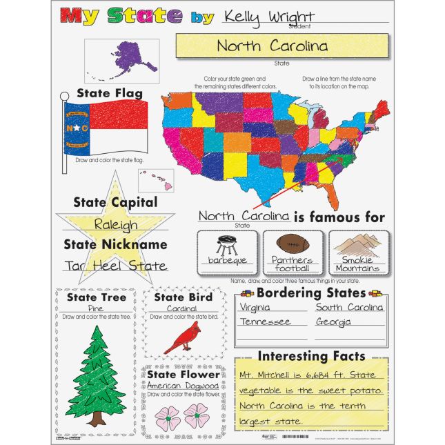
These ready-to-decorate posters are a perfect format for students to record information about the American states. Each poster has a place to write about the state, including its capital, flag, nickname, tree, bird, flower, bordering states, and interesting facts.
View Full Product Description
View Full Product Description
Close

Engage students and foster a sense of belonging
View More
View More
Engage students and foster a sense of belonging with our Ready-to-Decorate poster! Designed for young learners, these posters help students recognize their community, from near to far. Featuring the United States, their state, city/town, school, and neighborhood, students are invited ...
View Full Product Description
View Full Product Description
Close
Explore the continents of the world and some
View More
View More
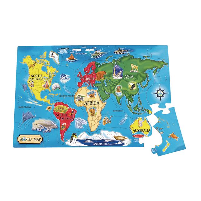
Explore the continents of the world and some of their animal inhabitants. 2' x 3' when assembled, the 33 extra-thick pieces are 20% thicker than the competition's. Its easy-clean surface keeps puzzle looking new. Make learning geography fun!
View Full Product Description
View Full Product Description
Similar Products